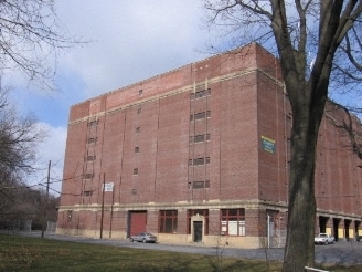
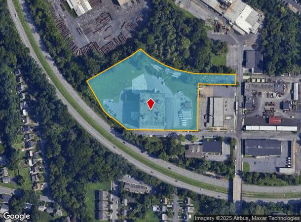
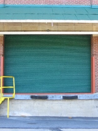
Property Record
1650 Gary St, Bethlehem, PA 18018
NEARBY LISTINGS FOR SALE OR LEASE
Property Detail
1650 Gary St
641890330683-1
LOTS: 008
Warehouse
Lehigh
X
Pennsylvania
42095C0244E
8
2025
5.70 AC
2025
Lehigh Valley
009100
Philadelphia
211,180 SF
Allentown-Bethlehem-Easton, PA-NJ
DEMOGRAPHICS near 1650 Gary St
1 Mile
3 Mile
5 Mile
2024 Total Population
15,338
98,382
255,104
2029 Population
15,289
98,817
256,718
Pop Growth 2024-2029
(0.32%)
+ 0.44%
+ 0.63%
Average Age
43
39
39
2024 Total Households
6,494
38,433
97,349
HH Growth 2024-2029
(0.52%)
+ 0.55%
+ 0.72%
Median Household Inc
$61,462
$58,255
$57,721
Avg Household Size
2.20
2.30
2.50
2024 Avg HH Vehicles
2.00
2.00
2.00
Median Home Value
$213,137
$198,381
$206,361
Median Year Built
1955
1955
1957
Nearby Places
Map Layers
Map Styles
 Street
 Aerial
- Restaurants
- Banks
- Shops
- Fitness
- Groceries
PUBLIC TRANSPORTATION
AIRPORT
Lehigh Valley International
DRIVE
WALK
Distance
Lehigh Valley International
11 min
5.8 mi
Freight Ports
Port of Philadelphia
DRIVE
WALK
Distance
Port of Philadelphia
1 min
47.7 mi
SALE & LEASE HISTORY
LISTING DATE
SALE/LEASE

Sep 25, 2016
For Lease
Nearby Properties
Address
Land Use
TOTAL SIZE
Lot Size
Zoning
Address
Land Use
TOTAL SIZE
Lot Size
Zoning
541,843 SF
35.82 AC
INST
Address
Land Use
TOTAL SIZE
Lot Size
Zoning
425,507 SF
52.58 AC
HI
Address
Land Use
TOTAL SIZE
Lot Size
Zoning
93,719 SF
789.61 AC
AI
Address
Land Use
TOTAL SIZE
Lot Size
Zoning
649,498 SF
22.51 AC
I
Address
Land Use
TOTAL SIZE
Lot Size
Zoning
298,543 SF
55.08 AC
PIO
Address
Land Use
TOTAL SIZE
Lot Size
Zoning
520,201 SF
77.66 AC
PIO
Address
Land Use
TOTAL SIZE
Lot Size
Zoning
13,164 SF
27.89 AC
RT
Address
Land Use
TOTAL SIZE
Lot Size
Zoning
25.75 AC
B/LI
Address
Land Use
TOTAL SIZE
Lot Size
Zoning
184,739 SF
6.75 AC
I
Address
Land Use
TOTAL SIZE
Lot Size
Zoning
29,982 SF
14.39 AC
RT
Address
Land Use
TOTAL SIZE
Lot Size
Zoning
252,920 SF
12.88 AC
I-G
Address
Land Use
TOTAL SIZE
Lot Size
Zoning
72,678 SF
17.21 AC
PC
Address
Land Use
TOTAL SIZE
Lot Size
Zoning
509,445 SF
43.15 AC
PIO
Address
Land Use
TOTAL SIZE
Lot Size
Zoning
104,379 SF
21.57 AC
CS
Address
Land Use
TOTAL SIZE
Lot Size
Zoning
164,451 SF
15.06 AC
PI
Address
Land Use
TOTAL SIZE
Lot Size
Zoning
12,838 SF
36.50 AC
IP
Address
Land Use
TOTAL SIZE
Lot Size
Zoning
326,320 SF
11.73 AC
PC
Address
Land Use
TOTAL SIZE
Lot Size
Zoning
133,912 SF
0.79 AC
I-3
Address
Land Use
TOTAL SIZE
Lot Size
Zoning
19,581 SF
15.99 AC
R-MP
Address
Land Use
TOTAL SIZE
Lot Size
Zoning
57,441 SF
19.85 AC
CS
Address
Land Use
TOTAL SIZE
Lot Size
Zoning
8,352 SF
17.24 AC
MR
Address
Land Use
TOTAL SIZE
Lot Size
Zoning
11,856 SF
454.48 AC
CM
Address
Land Use
TOTAL SIZE
Lot Size
Zoning
332,641 SF
2.27 AC
HI
Address
Land Use
TOTAL SIZE
Lot Size
Zoning
134,774 SF
11.74 AC
PC
Address
Land Use
TOTAL SIZE
Lot Size
Zoning
100,754 SF
16.01 AC
PIO
Address
Land Use
TOTAL SIZE
Lot Size
Zoning
80,277 SF
3.23 AC
MHDR
Address
Land Use
TOTAL SIZE
Lot Size
Zoning
189,805 SF
11.43 AC
I-3
Address
Land Use
TOTAL SIZE
Lot Size
Zoning
208,440 SF
18 AC
B/LI
Address
Land Use
TOTAL SIZE
Lot Size
Zoning
35,877 SF
9 AC
R-MH
Address
Land Use
TOTAL SIZE
Lot Size
Zoning
75,091 SF
5.23 AC
PUD
The World's #1 Commercial Real Estate Marketplace
Connect with us
© 2025 CoStar Group
The information above has been obtained from sources believed reliable. While we do not doubt its accuracy we have not verified it and make no guarantee, warranty or representation about it. It is your responsibility to independently confirm its accuracy and completeness. Any projections, opinions, assumptions, or estimates used are for example only and do not represent the current or future performance of the property. The value of this transaction to you depends on tax and other factors which should be evaluated by your tax, financial, and legal advisors. You and your advisors should conduct a careful, independent investigation of the property to determine to your satisfaction the suitability of the property for your needs.